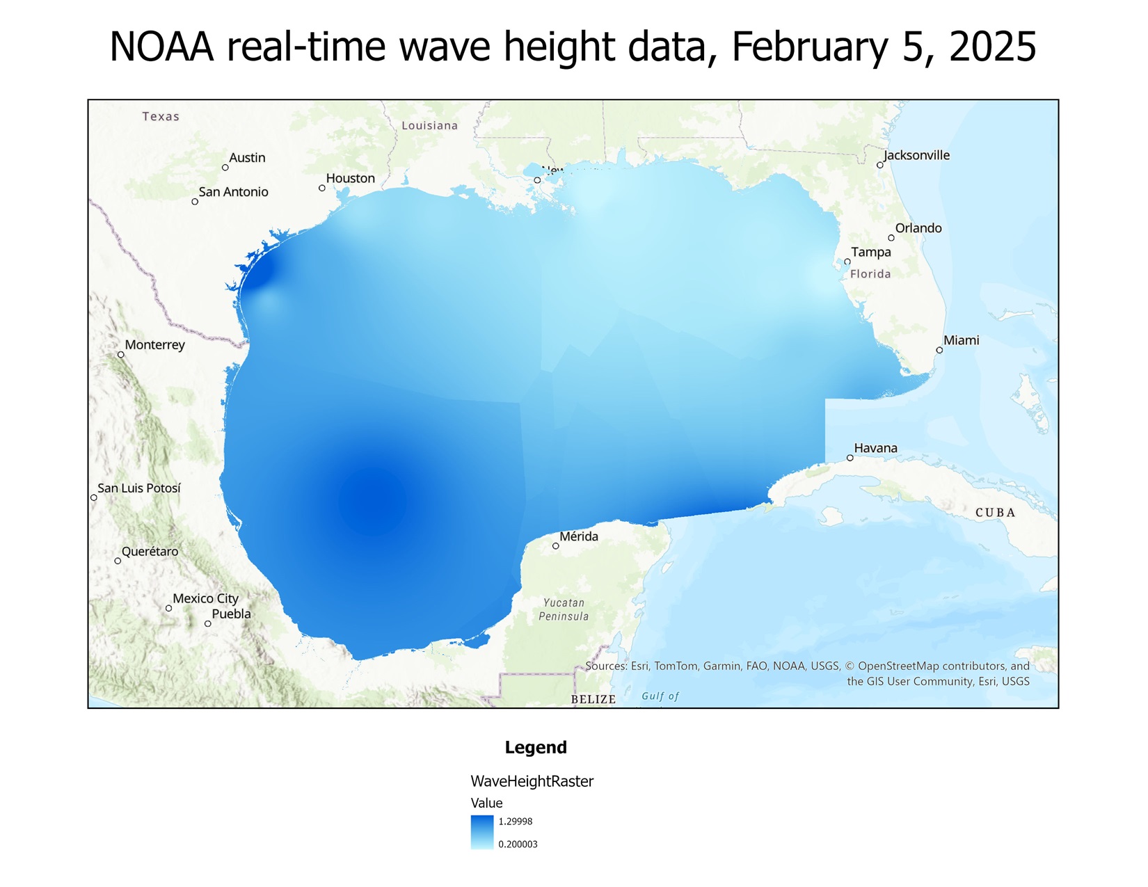
I have recently begun learning how to use Python with ArcGIS, as that is a valuable skill for a GIS Analyst to have for a variety of reasons. In this case, I was able to create a Python script to obtain real-time data from over 300 National Oceanic and Atmospheric Administration buoys in the Gulf of Mexico, and automatically clip the output raster to a shapefile I downloaded from marineregions.org. This was an eye-opening insight into how Python can be used with ArcGIS to greatly speed up processes that would otherwise take a very long time to do manually.
My next research project is planned to revolve around forest restoration & conservation, and will attempt to use Python to answer some key questions whilst also being a showcase of my journey through learning how to use Python with ArcGIS. Stay tuned!