In the previous posts of this series, I explored the potential for ecological restoration and reforestation in the Washington Cascades, […]
Bridging the Divide – Building a Simple Suitability Model (edited)
In my previous post, I laid out the broad goal of this project: to assess the feasibility of reforestation and […]
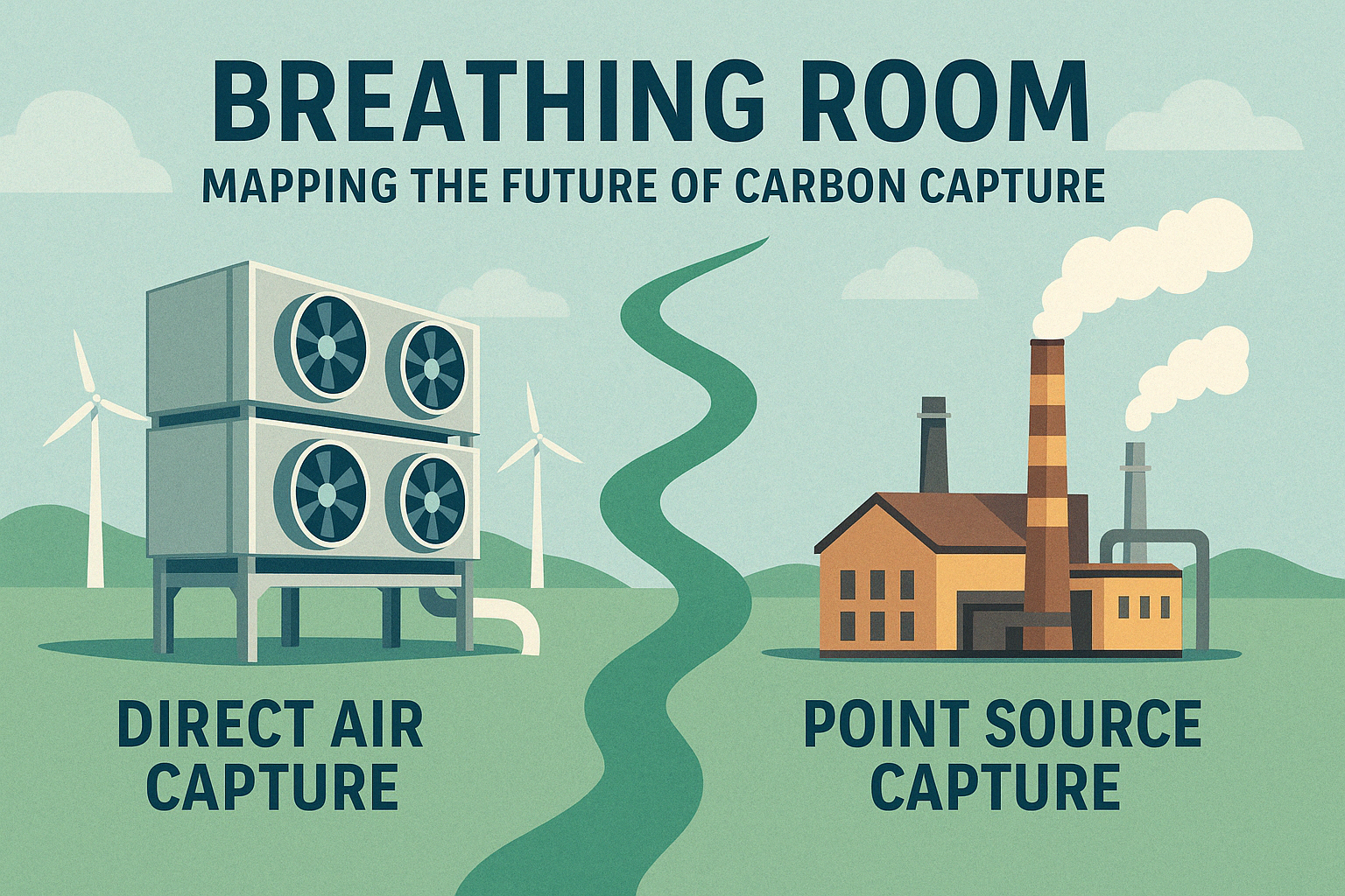
Breathing Room: A Visual Update to My Carbon Capture Suitability Project
Back when I first created Breathing Room, I was focused on modeling where infrastructure could align with subsurface geology—particularly in […]
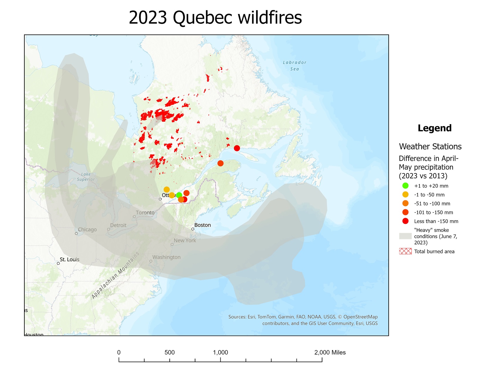
Mapping the Flames: Supplemental Visual Charts
Lessons from Esri UC 2025 In one of the more insightful sessions from this year’s Esri User Conference, presenter Flora […]
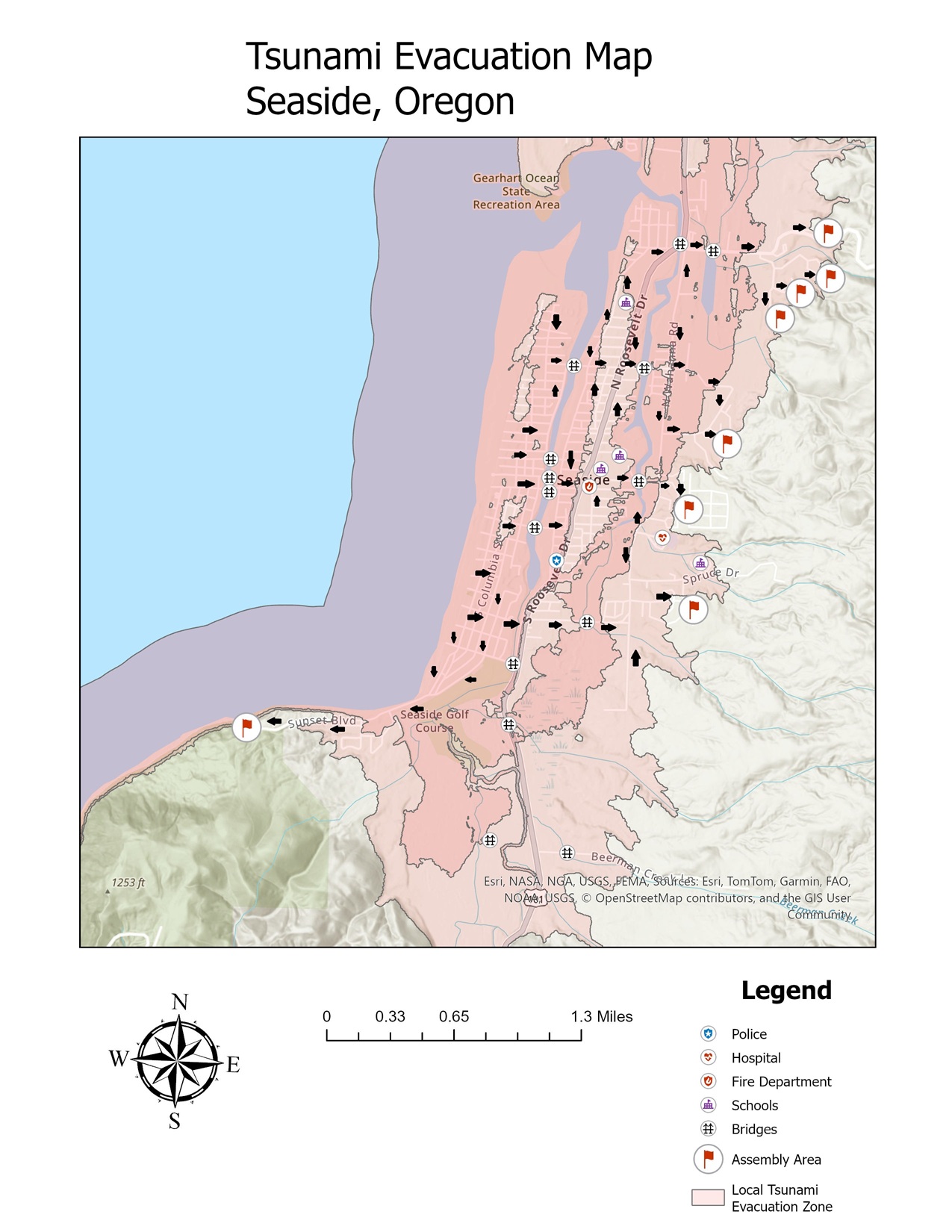
Mapping for Resilience: Redesigning My Tsunami Map With The End User In Mind
When I first explored the Cascadia Subduction Zone and its tsunami risk for coastal towns like Seaside, Oregon, my goal […]
Breathing Room: Final Reflections: Mapping a Carbon Capture Future
When I began this project, my central question was deceptively simple: Where should we build carbon capture systems in the […]
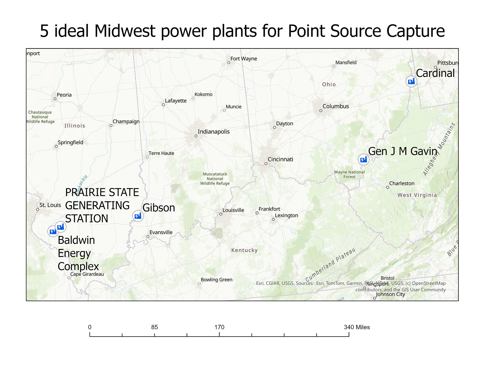
Breathing Room: Moving Beyond False Dichotomy, And Blending Direct and Point Source Carbon Capture
Throughout this project, I explored where carbon capture technologies might be most geographically and geologically feasible in the U.S. — […]
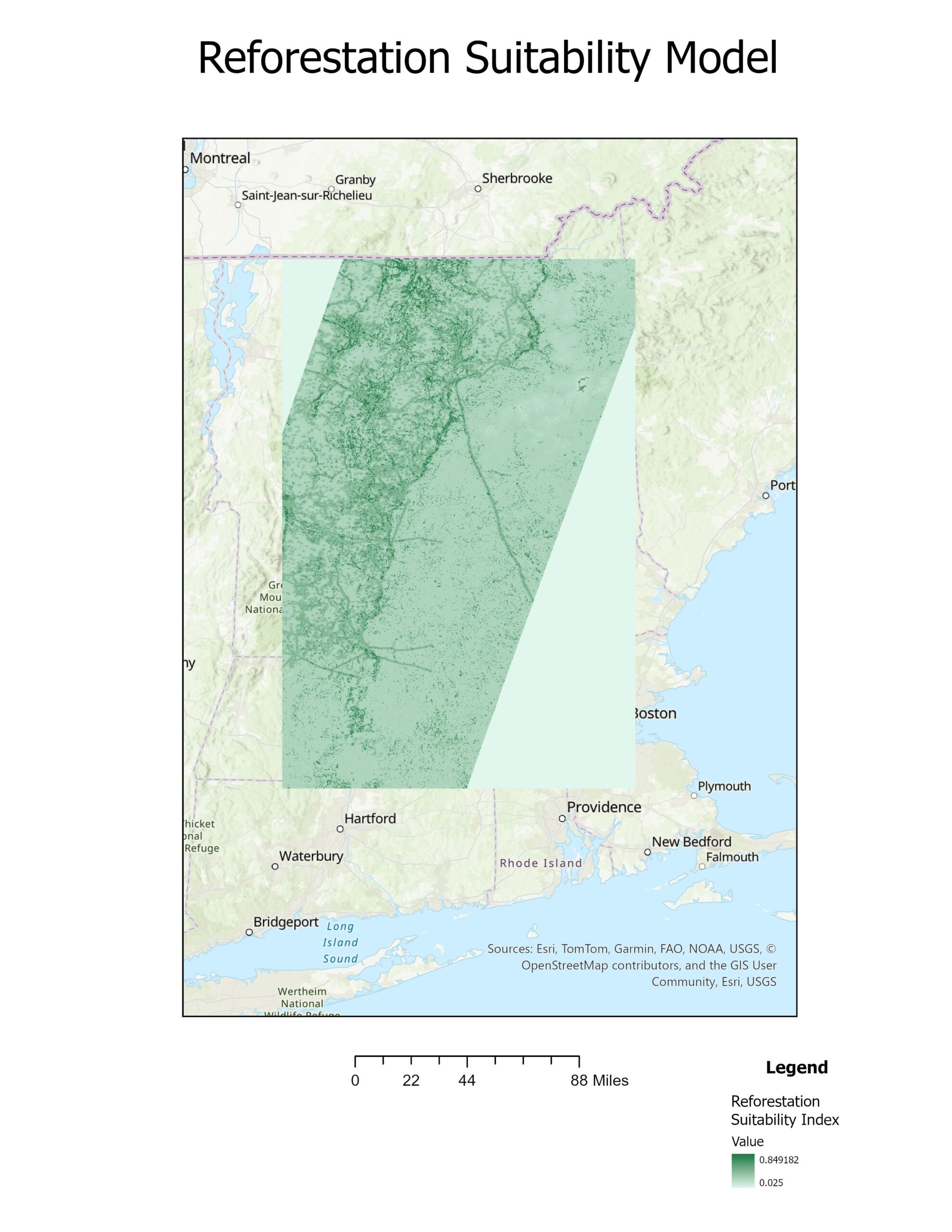
Coding for the Forest: My Journey Building a Reforestation Suitability Model with Python & GIS
Introduction I’ve always had a deep appreciation for forests and the role they play in maintaining our planet’s health. But […]
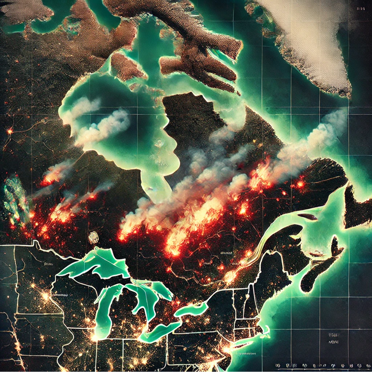
Revisiting my Quebec Wildfires project with Python: The Numbers Surprised Me
As I continue learning how to use Python with ArcGIS, I decided to revisit my previous Wildfires Project, with one […]
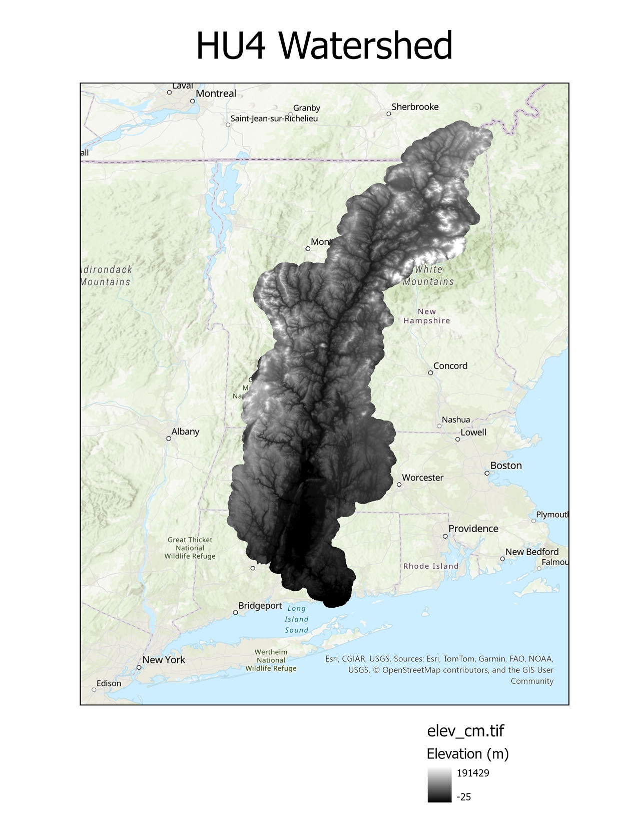
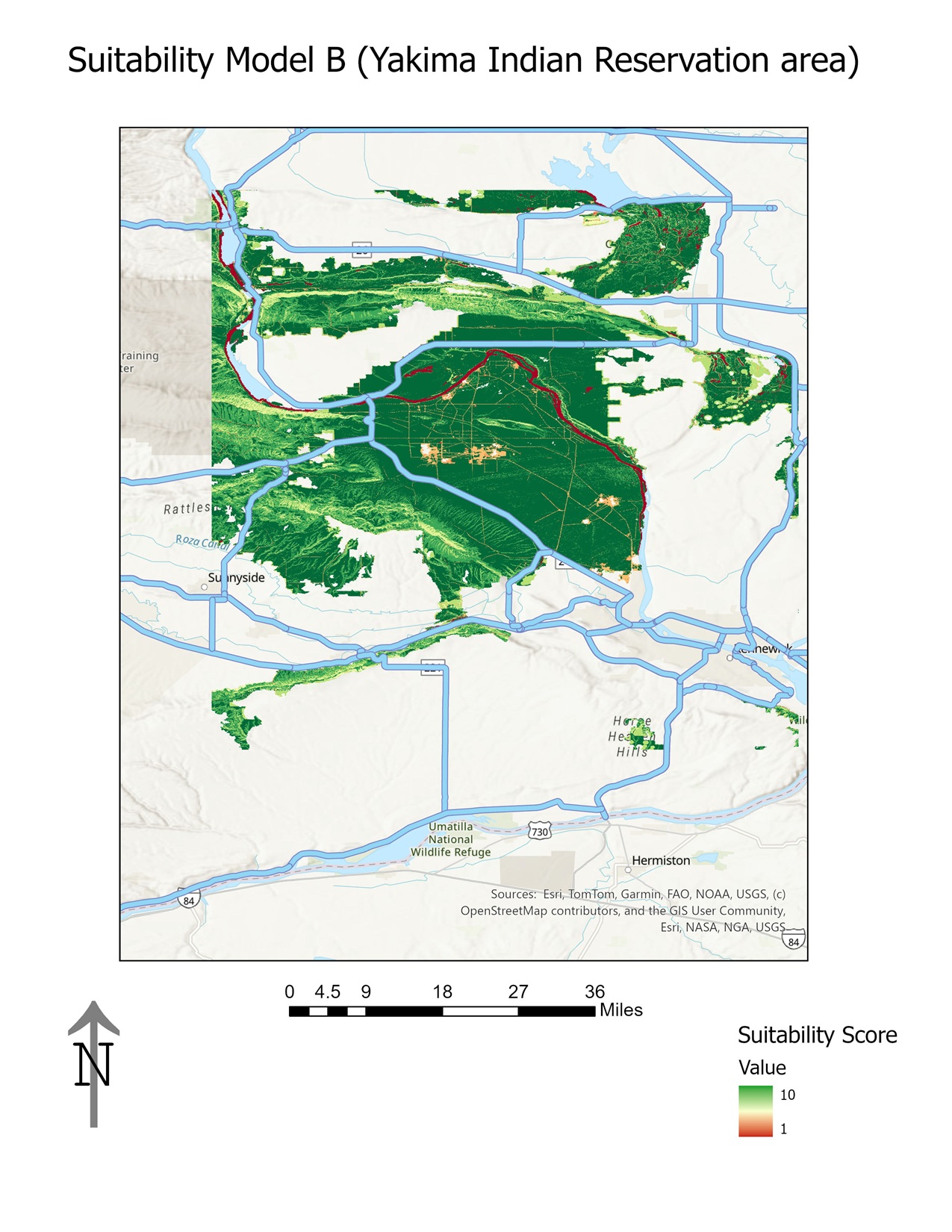
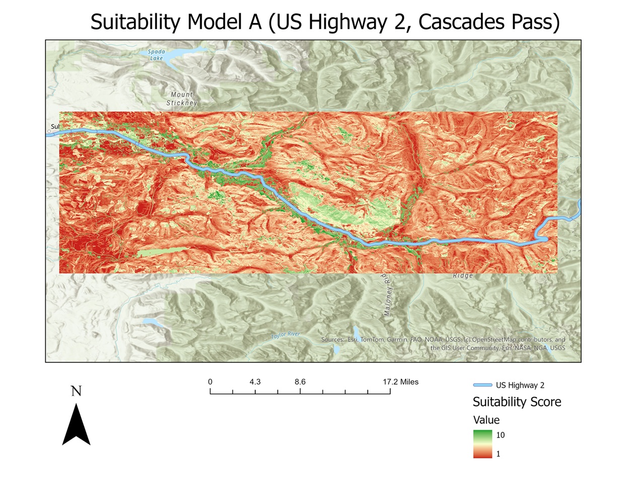
Coding for the Forest: Choosing My Reforestation Study Area
When I began this project, I knew I wanted to build a GIS model that could help identify the best […]