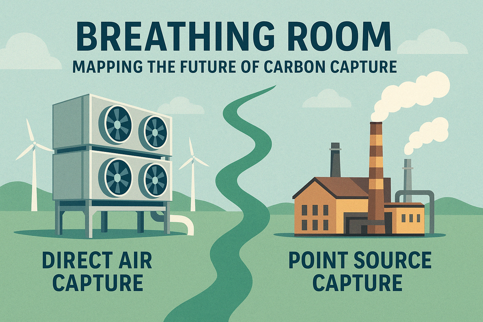
Carbon capture and storage (CCS) is often hailed as a critical tool in the fight against climate change. But not […]

Coding for the Forest: What I Learned Using Python with ArcGIS (as a Beginner)
When I started my reforestation suitability model, I had a clear goal: identify the best areas for replanting trees using […]
Coding for the Forest: My Journey Building a Reforestation Suitability Model with Python & GIS
Introduction I’ve always had a deep appreciation for forests and the role they play in maintaining our planet’s health. But […]
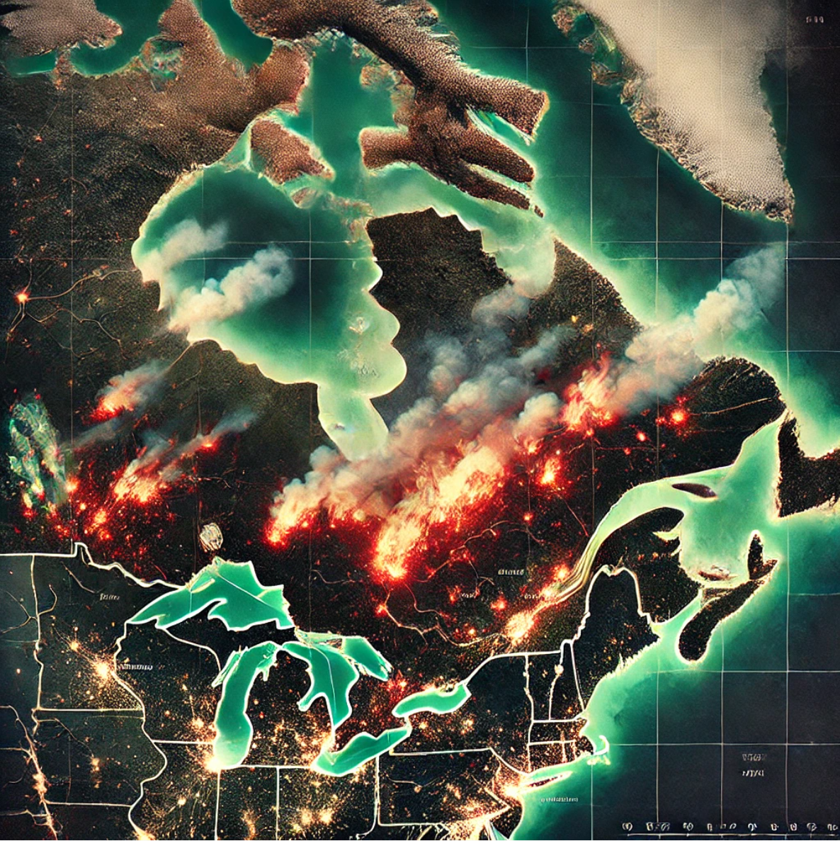
Revisiting my Quebec Wildfires project with Python: The Numbers Surprised Me
As I continue learning how to use Python with ArcGIS, I decided to revisit my previous Wildfires Project, with one […]
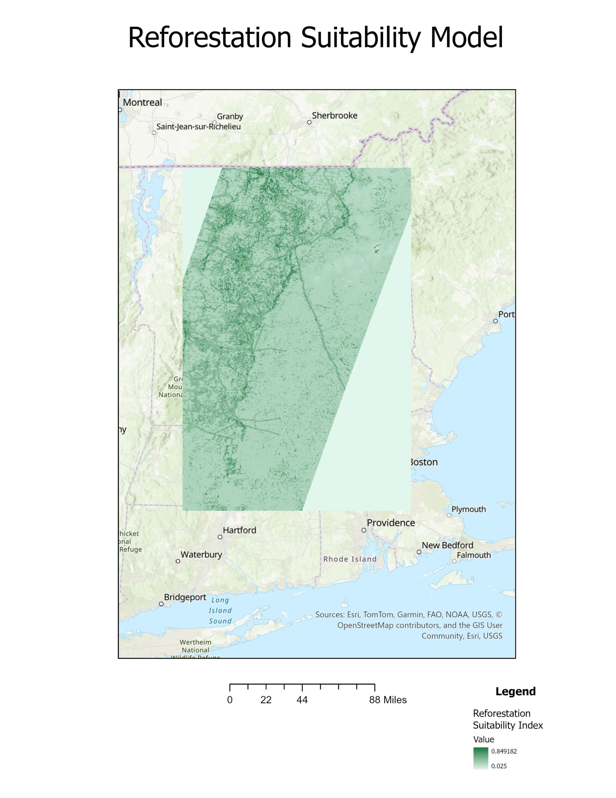
Coding for the Forest: Choosing My Reforestation Study Area
When I began this project, I knew I wanted to build a GIS model that could help identify the best […]
Coding for the Forest: Building a Reforestation Suitability Model
When it comes to restoring forests, one of the most important questions to ask is: Where should we focus our […]
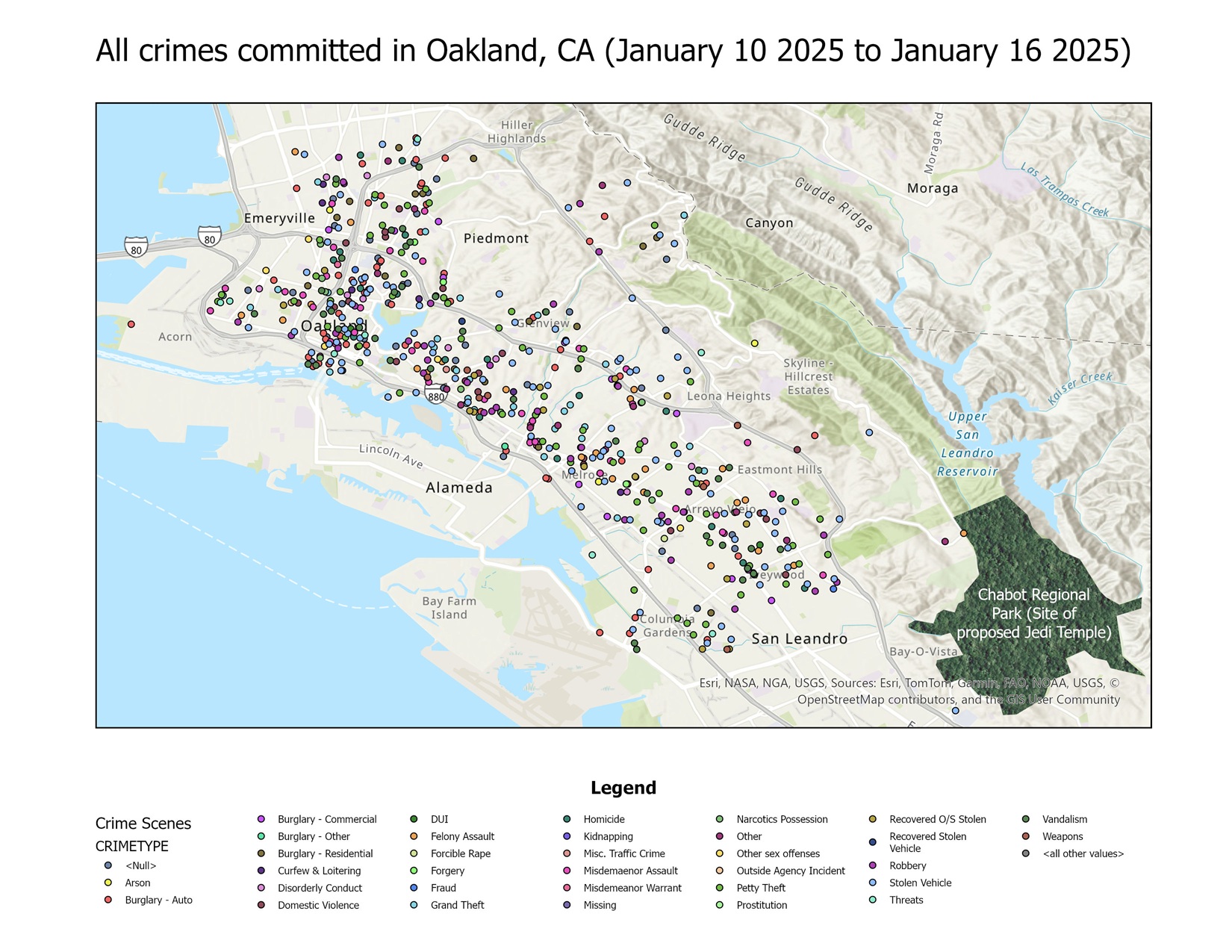
The Final Decision: Building the US Jedi Temple in Oakland, California
After analyzing crime data, land use patterns, and other key statistics, I have determined that Oakland, California, is the best […]
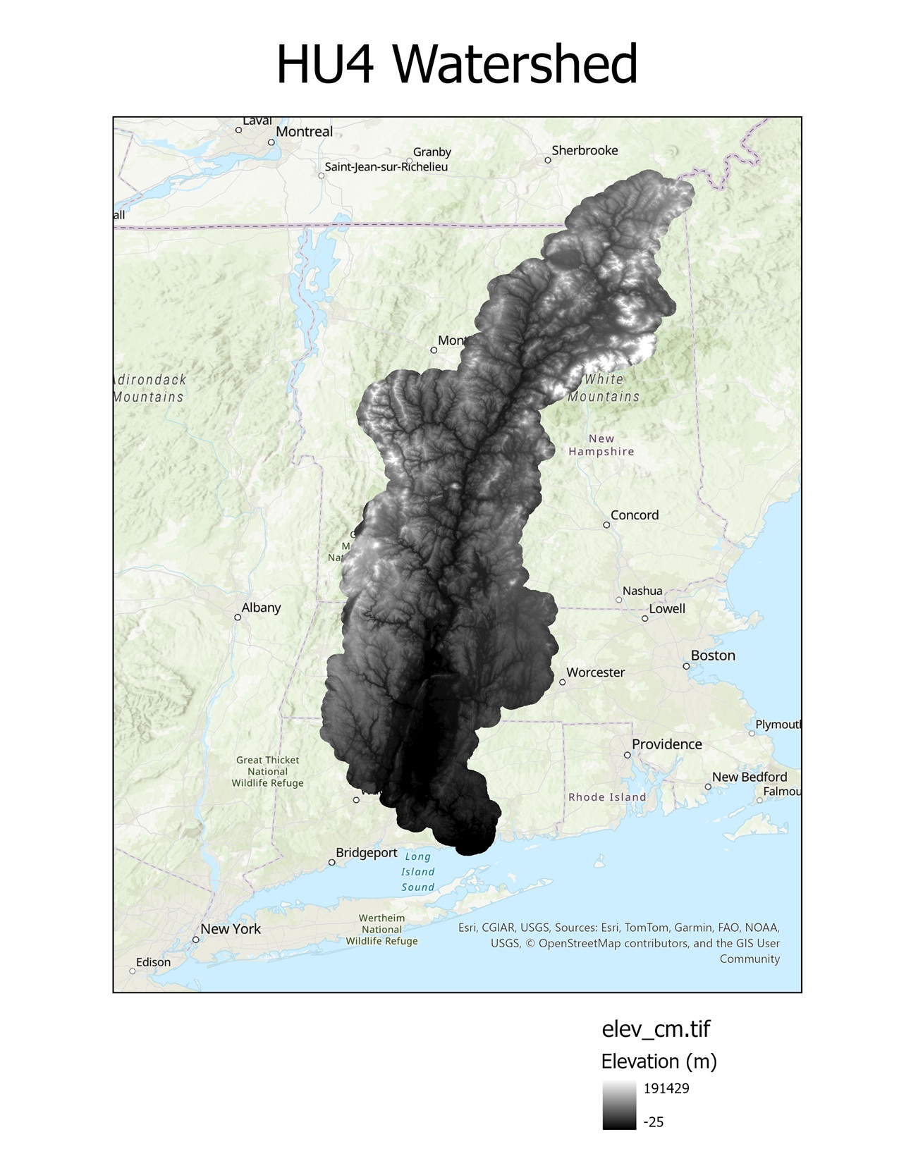
Mapping for the Forest: Using GIS & Python to Identify the Best Locations for Reforestation
Introduction Forests are a cornerstone of our planet’s health, playing a critical role in biodiversity, carbon sequestration, and water cycle […]
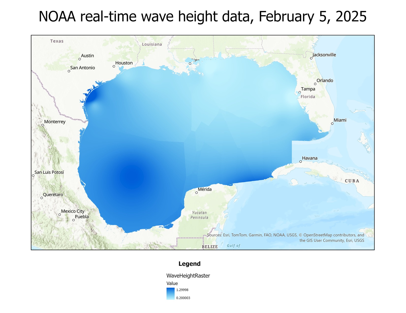
Using Python to create a map from real-time buoy data from NOAA
I have recently begun learning how to use Python with ArcGIS, as that is a valuable skill for a GIS […]
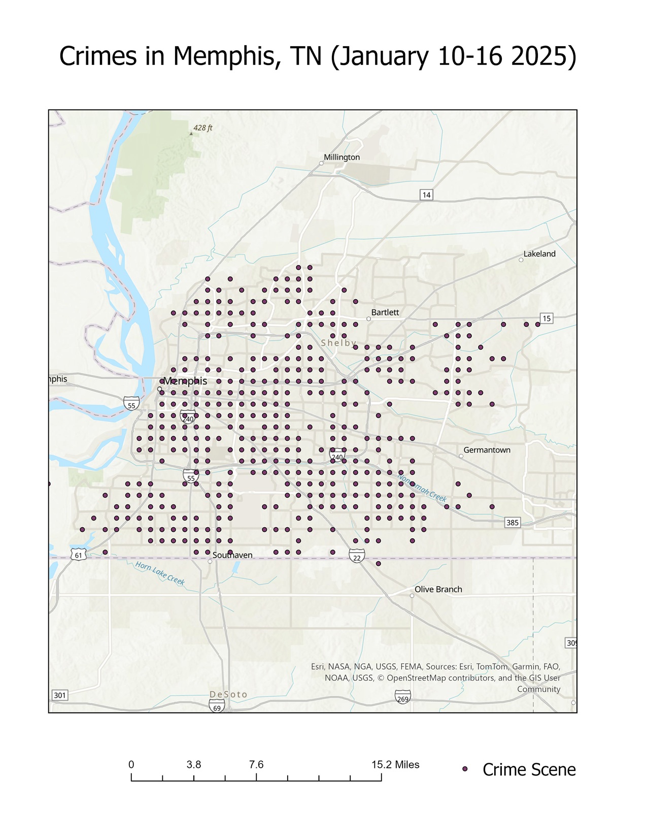
The best city in the US for a Jedi Temple: Oakland or Memphis?
In my previous post, I explored five potential cities for the location of a Jedi Temple: St. Louis, Missouri; Oakland, […]