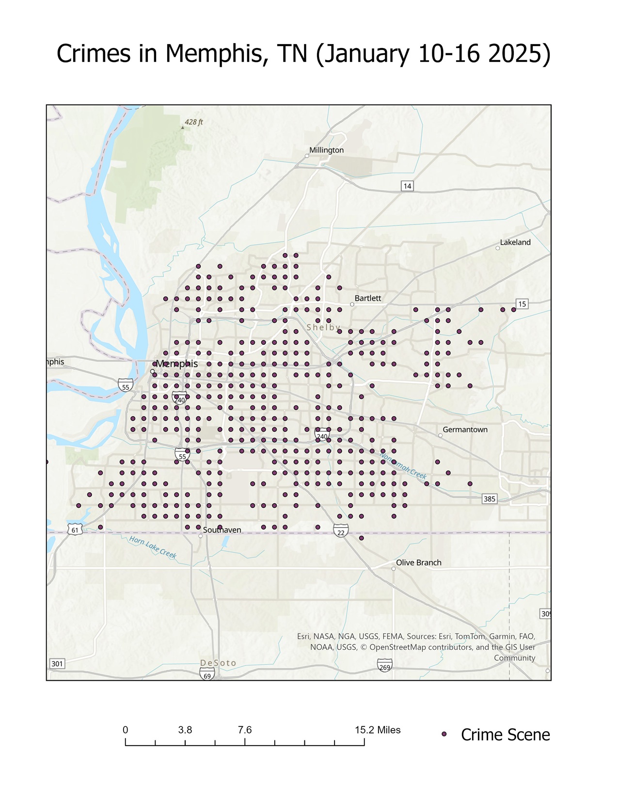
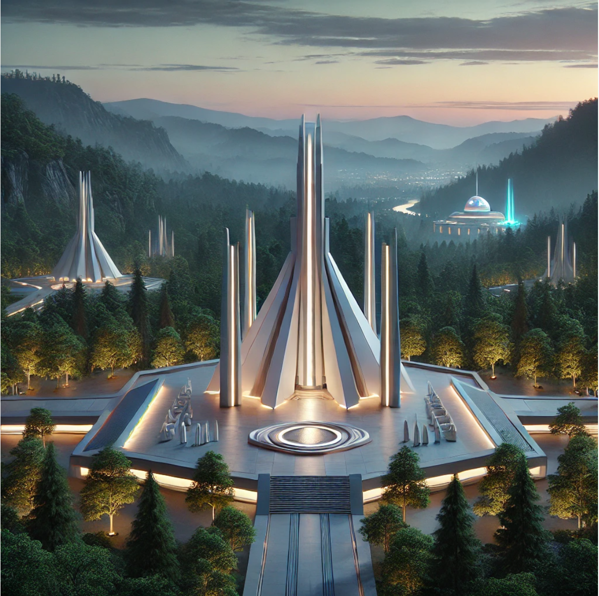
In my previous post, I explored five potential cities for the location of a Jedi Temple: St. Louis, Missouri; Oakland, […]
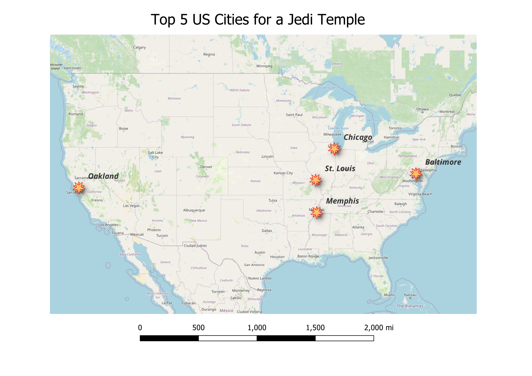
Exploring the Top Five Cities for a Jedi Temple: A GIS Analysis
In my quest to identify the ideal location for a Jedi Temple in the United States, I’ve narrowed my focus […]
Where would a Jedi Temple be built in the United States?
In my college years, my final project for Advanced GIS class was well received by my peers and instructors alike: […]
Mapping for Resilience: Final Report – Understanding the Cascadia Megaquake and Tsunami
Original Hypothesis The Pacific Northwest is at significant risk from the future Cascadia Megaquake and Tsunami, and effective mapping using […]

Mapping For Resilience: Comparing Tsunami Preparedness in Seaside, Oregon & Westport, Washington
When it comes to tsunami preparedness, coastal communities must adapt to their unique geographies and resources to protect residents and […]
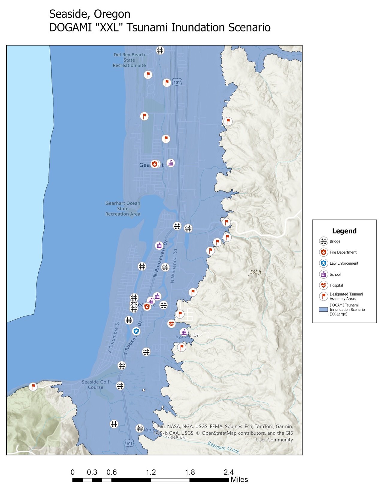
Mapping for Resilience: DOGAMI’s “XXL” tsunami inundation zone
Examining the Risks: A tsunami in Seaside, Oregon Seaside, a popular Oregon town for beachgoers, sits on the frontlines of […]
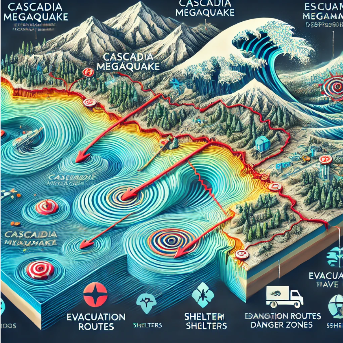
Mapping for Resilience: Understanding the Cascadia Megaquake & Tsunami
The Pacific Northwest sits atop a ticking geological time bomb: the Cascadia Subduction Zone. This massive fault line, stretching over […]
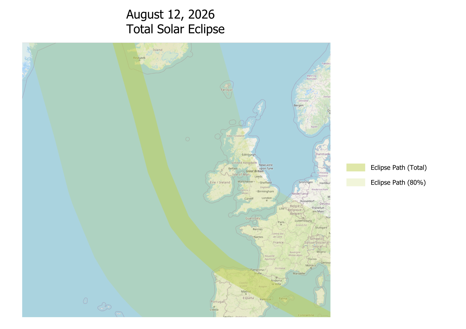
Chasing Shadows: A Solar Eclipse Journey and the Power of GIS Mapping
Premise On April 8, 2024, I had the privilege of witnessing the awe-inspiring total solar eclipse from Syracuse, NY. Although […]
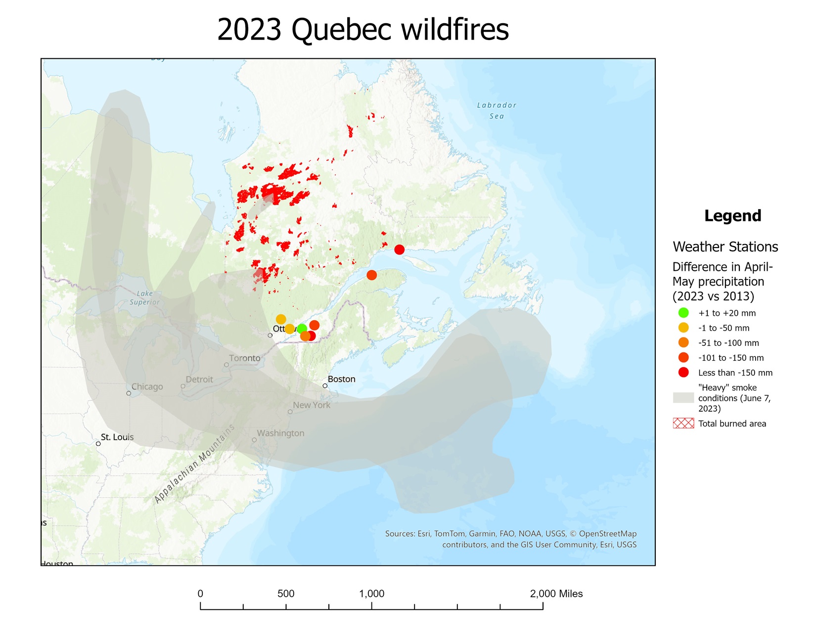
Mapping the Flames (Final Report): The Role of Climate Change in the 2023 Quebec and Ontario Wildfire Season
Introduction The 2023 wildfire season in Quebec and Ontario was one of the most severe in recent history, marked by […]

Mapping the Flames: Working with satellite data
The Premise In my GIS project on wildfires in Ontario and Quebec, one of the most valuable tools I have […]